
Swiss investigators have finally completed their report into the tragic death of cyclist Muriel Furrer, who was 18 at the time, in a 2024 road race that was part of the Road World Championships, the top level of official global competition in the sport.
Indeed, the Worlds can be considered the pinnacle of global cycling competitions, with the victor in each category uniquely entitled, out of everyone on the planet, to wear the so-called rainbow jersey for the next 12 months.
(Whether a rainbow jersey stands above Olympic gold or not is a matter of opinion, but even the very best cyclists of each generation don’t always manage to win both.)
Racers knowingly take risks when competing at high level, given that they race against one another over long distances, often on steep and difficult courses, under physically draining conditions.
However, the International Cycling Union (UCI, or Union Cycliste Internationale) strictly enforces often-conservative rules that it says serve to reduce the likelihood of crashes in the first place, and to minimize the hazards faced by riders.
For example, bikes have a minimum mass, to discourage teams from going too far in their effort to shave off material and save weight; helmets are mandatory; tires are limited in diameter to restrict speeds somewhat on very steep descents; marshals monitor riders’ progress during races, which may cover several hundred kilometers over many hours; and roads are closed and signposted to keep rogue vehicles off the course.
One obvious precaution in the modern cycling era would be to require all competitors to ride with a live tracking device, given that these are cheap and easy to buy and use.
Indeed, many amateur cyclists these days quite willingly track all their rides, sometimes storing their routes and timings in a handlebar-mounted unit for upload later, but often streaming their locations live as they ride, allowing friends, family and fellow riders to keep tabs on where they are.
Some handlebar head units can go online themselves if fitted with a mobile phone SIM card, but even the smallest and cheapest devices these days can pair via Bluetooth with a mobile phone kept out of harm’s way in a saddlebag, pannier or rucksack.
There don’t seem to be too many privacy concerns over allowing yourself be tracked during an official race, especially one at the highest level, where the competitor list is a matter of public record, as is the course.
After all, if you perform as your talent might reasonably suggest, your approximate location at any time during the race can be predicted fairly well by anyone, so beaming a list of precise times and locations back to the race organizers every few seconds, or even every minute, doesn’t sound like much of a privacy or cybersecurity risk.
Yet when Furrer raced in 2024, there was no location tracker fitted to her bicycle, because she was prohibited by the race rules of the day from having one.
Some bike races do allow live tracking, not least because cycling is a wildly popular spectator sport in Europe, and fans following a race, whether in person or online, love to be able to use their own mobile phones to track the progress of the racers, spot breakaways, see who’s fallen back from the main group, and so on.
But other races, including the 2024 World Championships, banned live tracking and two-way communication between teams and riders, presumably on the grounds that part of the skill and the pluck in racing should be that riders compete directly with one another based on experience and personal observation, without continual instructions and competitive updates delivered “via the cloud.”
Sadly for Ferrer, she crashed heavily on a wet road in a wooded part of the course while not in a group of other riders, who could and would have called for help and assisted her.
As the BBC writes, the Zurich Public Prosecutors’ Office regrettably reported:
The accident occurred at approximately 11:04am, out of sight of support vehicles, race officials, spectators, and marshals. The injured cyclist lay hidden in the undergrowth and was not visible from the road. The sudden disappearance of [the] athlete was not automatically reported. Due to these circumstances, the injured cyclist was not discovered until 12:26pm.
If you’ve ever ridden in wooded conditions, especially in mountainous areas, you’ll know that the road can be surprisingly slippery even long after it’s stopped raining and the sun has come out; that visibility can be very poor, especially if you ride through occasional patches of sunlight that prevent your eyes staying adjusted to the shade; and that if you inadvertently veer off the road, you face a mixture of thick undergrowth to engulf you, and solid tree trunks to crash into.
Once Furrer had been spotted, first responders reached her within minutes and arranged for an emergency transfer to hospital, but she died of a head injury nevertheless.
She therefore first received treatment up to 80 minutes later than she might have if she’d had a live tracker fitted.
Even trackers with very modest amounts of processing power can detect “deceleration events” that suggest a crash rather than a controlled stop, and GPS geolocation is typically more than accurate enough to pinpoint that a rider has gone off the road.
When plotting my own rides, for example, using data from Garmin’s smallest and least expensive head unit, I can clearly see where I moved out to pass buses at bus stops, or where I turned at a roundabout [traffic circle] rather than at a regular cross-road intersection.
Apparently, live tracking has been authorized for Worlds events since the 2025 Championships in Rwanda, which lies in the Rift Valley and is known as the Land Of 1000 Hills, often with precipitous drops at the edges of twisty roads, so the organizers do now seem to agree that early information about competitors who may have crashed could save lives.
Of course, a cycling-related head injury suffered in a crash can be fatal even if the victim receives medical intervention immediately, but the added cost of compulsory location trackers, especially on steep and treacherous courses raced at the highest level (where bikes alone cost $10,000 or more), seems like a worthwhile precautionary expenditure in today’s always-connected world.
Ironically, there are plenty of rules, regulations, or unavoidable Terms and Conditions that lead to us being tracked, often intrusively (including forcing us to upload high-resolution images of ID documents to private companies in other countries, all to meet some legal requirement in our own country) when it’s hard to argue that this tracking benefits us in any way, and may in fact increase our risk of becoming cybercrime victims in future.
But in Muriel Furrer’s case, she couldn’t have opted in to location tracking even if she’d wanted to, although it might have led to her being rescued much more quickly.
Perhaps it’s time to get our tracking-and-tracing priorities aligned more usefully to the hazards and risks we actually face when we’re living our lives, whether we’re up against higher-than-usual risks by our own choice, or just going about tasks that we need to do whether we really want to or not?
Why not ask how SolCyber can help you do cybersecurity in the most human-friendly way? Don’t get stuck behind an ever-expanding convoy of security tools that leave you at the whim of policies and procedures that are dictated by the tools, even though they don’t suit your IT team, your colleagues, or your customers!

Paul Ducklin is a respected expert with more than 30 years of experience as a programmer, reverser, researcher and educator in the cybersecurity industry. Duck, as he is known, is also a globally respected writer, presenter and podcaster with an unmatched knack for explaining even the most complex technical issues in plain English. Read, learn, enjoy!
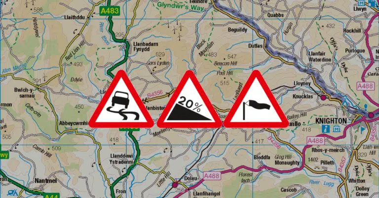
The area (surprisingly hilly, if not strictly mountainous) depicted in the featured image uses Ordnance Survey of Great Britain map imagery from Open Data 1:250 000 Scale Colour Raster under Open Government Licence v3.0. (Look at the Cymru/England border area around Llanbister Road Station at OS grid reference SO173716 – use file ras250_gb/data/SO.tif in the downloadable ZIP archive.)

By subscribing you agree to our Privacy Policy and provide consent to receive updates from our company.